4.014 BAI c1845 HOL BHM 1134 B14
Paper Scale: unk
Size: 55*37 cm Condition: poor – repaired for handling
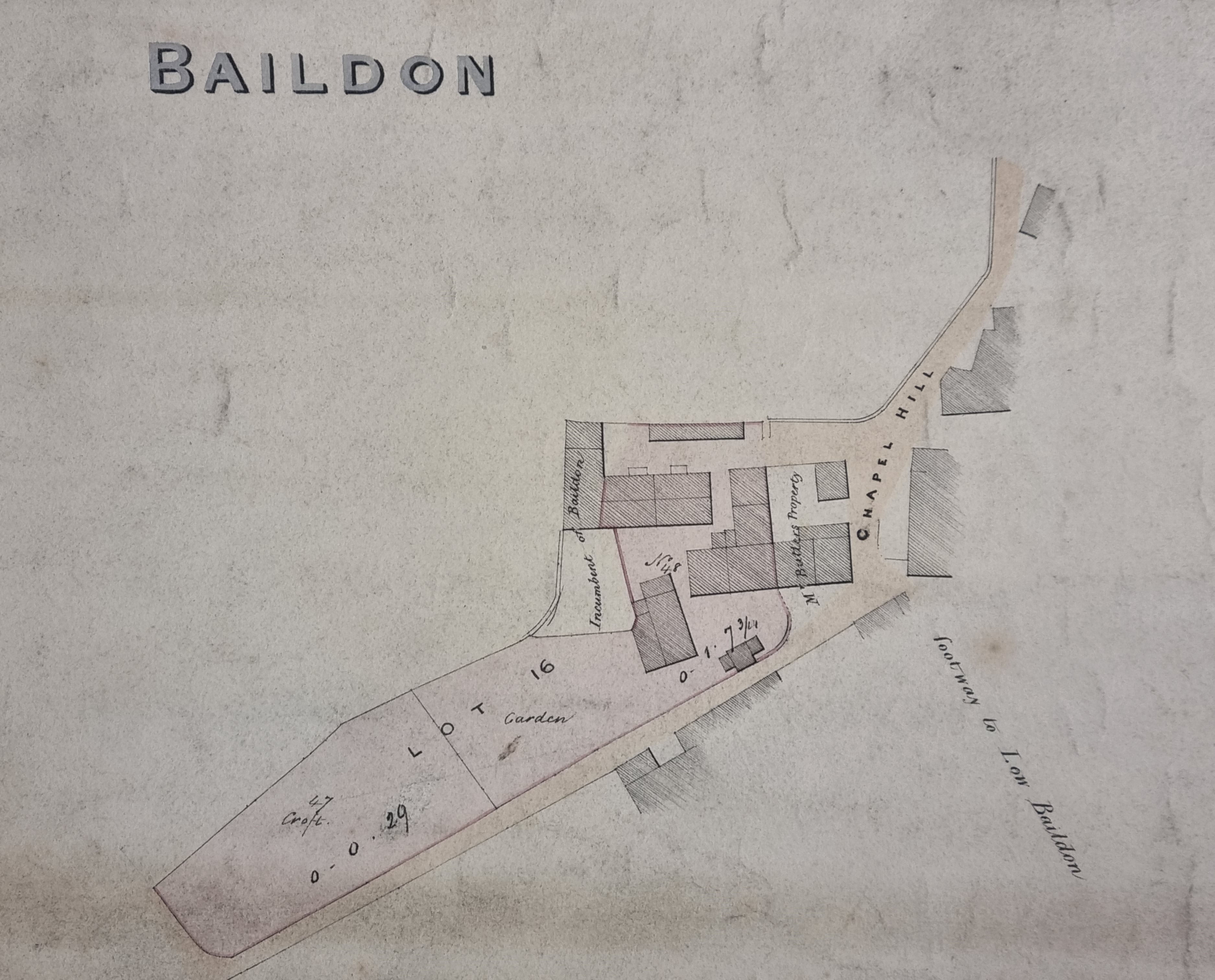
Although this plan from the Reserve Collection is undated, I think it is possible to identify it exactly. It is annotated ‘A16 Mr Hollings proprietor Baildon’ and shows lots 16 and 17 of a sale plan.
The overall topography closely resembles the first Ordnance Survey map, but the obvious question is ‘who is Mr Hollings?’ Another map from the reserve collection identifies some Baildon property as belonging to a Mr Thomas Hollings who we can reasonably assume is the same man.
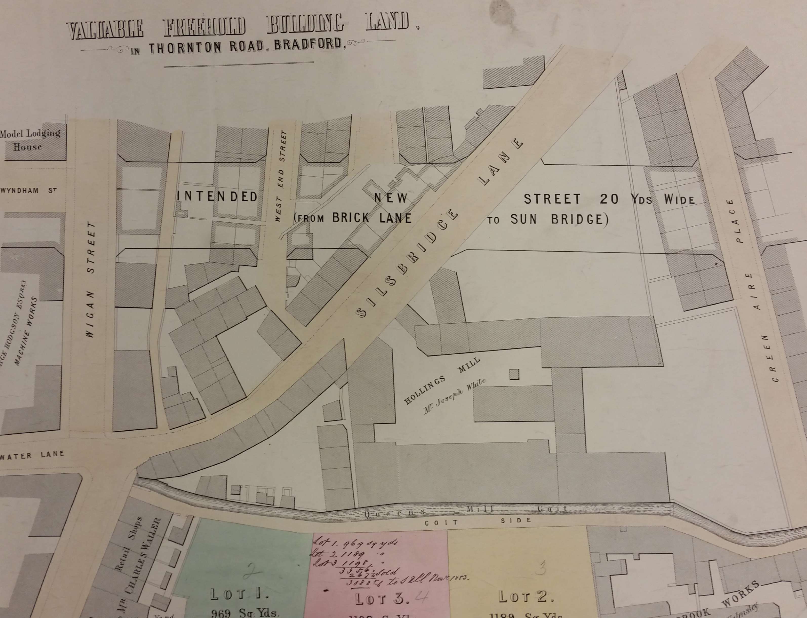
Hollings is a well-known textile surname in the Manningham area of Bradford. Hollings Mill, Silsbridge Lane (Lower Grattan Road), was constructed by Thomas and Joseph Hollings around 1830. In fact, Hollings Mill was occupied by Titus Salt before Saltaire, and portions of the mill still exist in the 21st century.
There are Land Tax records for Thomas Hollings, and his brother Joseph, in Manningham in the 1840s. In the 1841 Census Thomas Hollings, aged 60 is recorded as a worsted spinner at West House, Manningham. He has a wife Jane, and sons Isaac and Joseph, who are also spinners. But, by the time of the 1851 Census, Jane Hollings is a 68 year old widow and annuitant still living at West House. There are resident sons, Thomas and John, who are recorded as ‘proprietors of land and houses’.
The Hollings family were large land-owners in Baildon. Thomas Hollings himself had been born c.1781 and owned the Bull’s Head and other local property, but he didn’t live there. William Cudworth places his house, West Lodge, Manningham at the Duckworth Lane – Toller Lane junction. It was later the site of Woodlands, the house of Sir Angus Holden. Brother Joseph Hollings lived at Wheatley on Whetley Hill, opposite Whetley Lodge which has already featured in this series of maps.
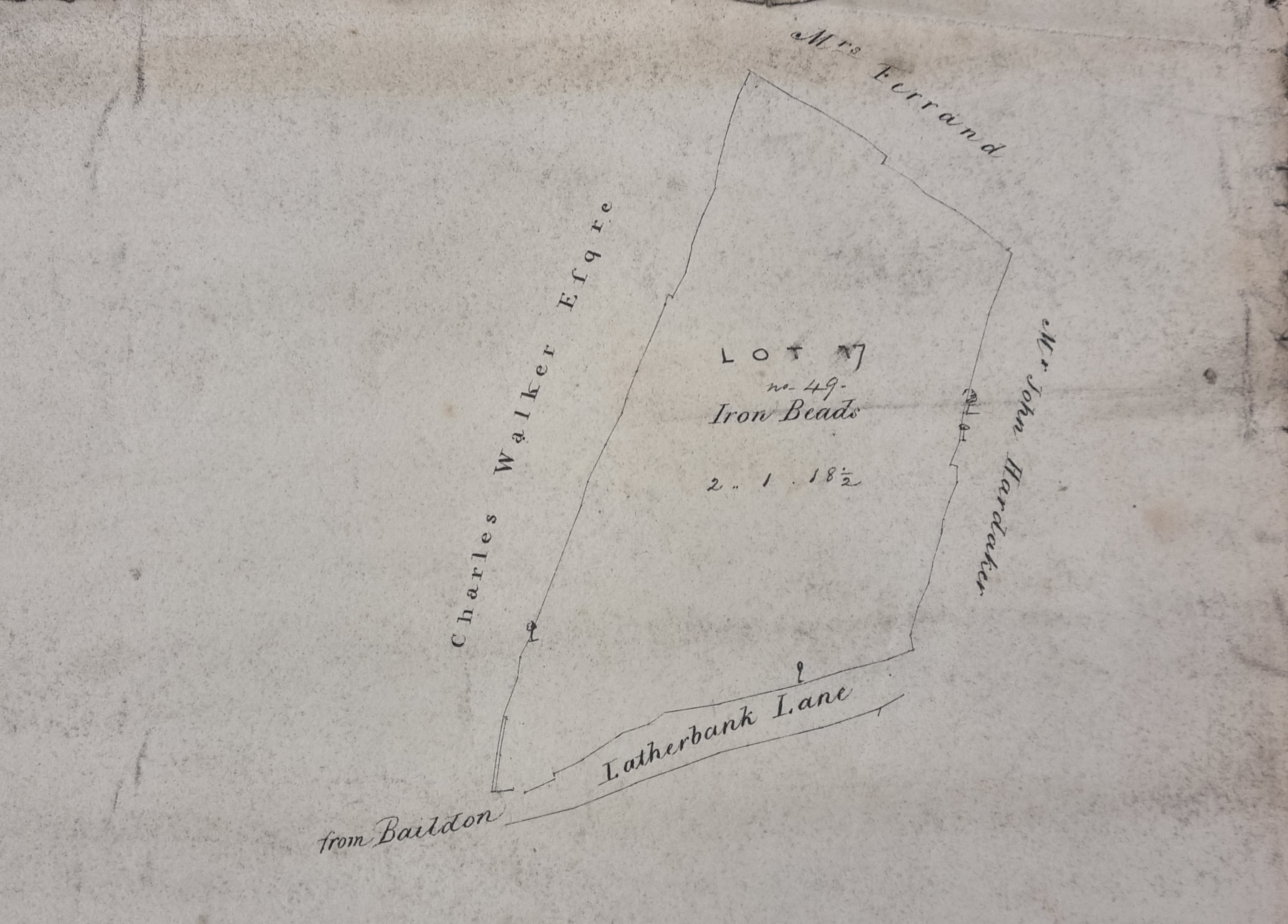
Fortunately, I have been able to identify a sale of Thomas Hollings’ lands to 13-14 April 1841 (Bradford Observer). Clearly there was a large offering of property in Baildon, Manningham and Bradford – including Hollings Mill. Specific to this map was Lot 16 ‘cottages, and John Walkers the Croft, house and wheelwright’s shop’. The Chapel Lane of the map seems more usually called Church Lane and it is near Baildon Parish Church. A second portion of the plan shows Lot 17 which was also part of the sale. Again, there are place name problems. The ‘Iron Beads’ on the plan are ‘Iron Beards’ in the sale advertisement, while Latherbank Lane is Ladderbanks Lane.
It would appear that by the 1840s the Hollings businesses were failing, and the brothers were selling land to raise money. This must have been shortly before the death of Thomas although, with my limited family history skills, I have not yet been able to precisely date this event. The last image, from a generation later, shows the location of Hollings Mill in relation to Goitside and Sunbridge Road which is just being developed, Silsbridge Lane is now Grattan Road.
 Bradford and District Libraries Map Collections