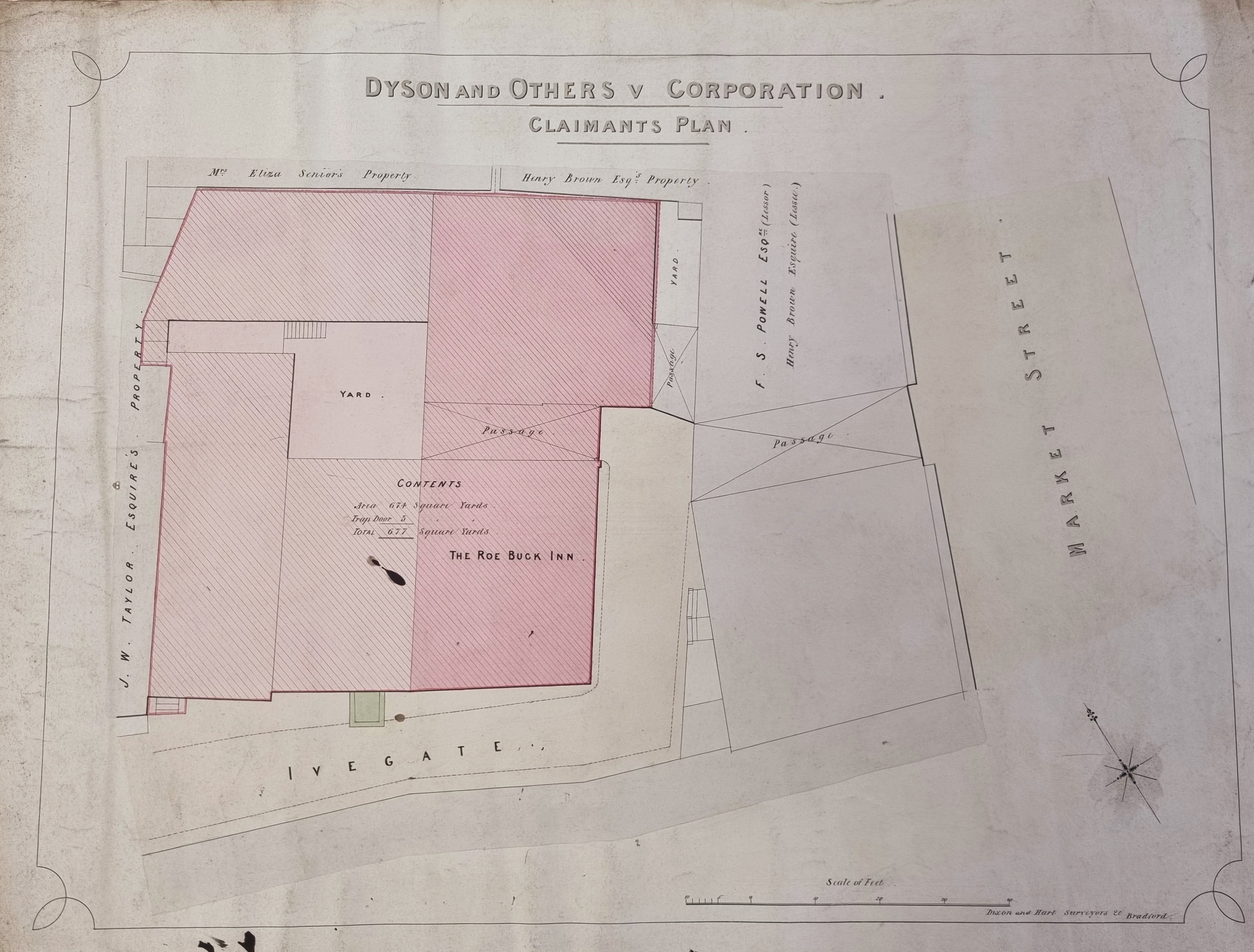
3.039 BRA c1865 DIX BHM 756 B11
Material: paper Scale: 40 ft per 5 inches
Size: 77*50 cm Condition: fair
I have posted this plan before, but its role in Bradford Chartism makes it worthy of reconsideration. I shall use the spelling Roebuck, but Roe Buck is also common. The structure of the inn is easier to see in the following detail. Rotate the image by 90 degrees clockwise to put north at the top.
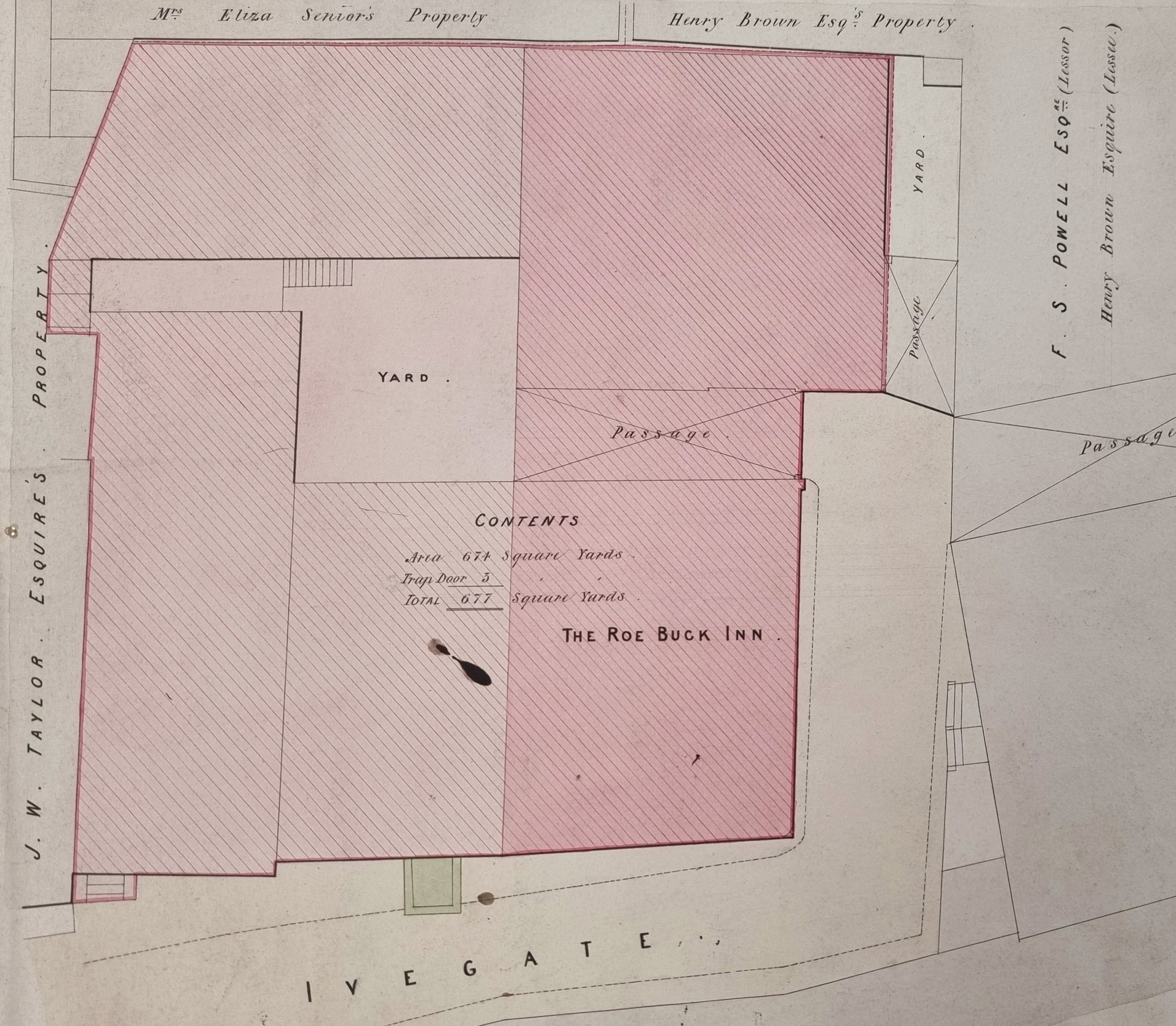
After the first posting I received some most helpful comments from Kieran Wilkinson, a photographer and local historian, who has put me right on several occasions. I was puzzled that the inn was given more than one number in Ivegate at various times in its history. I speculated that the location of the building might have moved but Kieran demonstrated that this was not the case. He found a press cutting from 1843 which refers to the hostelry as ‘The Roebuck Inn, Sun Bridge’ which would certainly place it at the bottom of Ivegate, and so plausibly at the location we see on the above plan. There may well have been renumbering in Ivegate, but we had one inn in a single location.
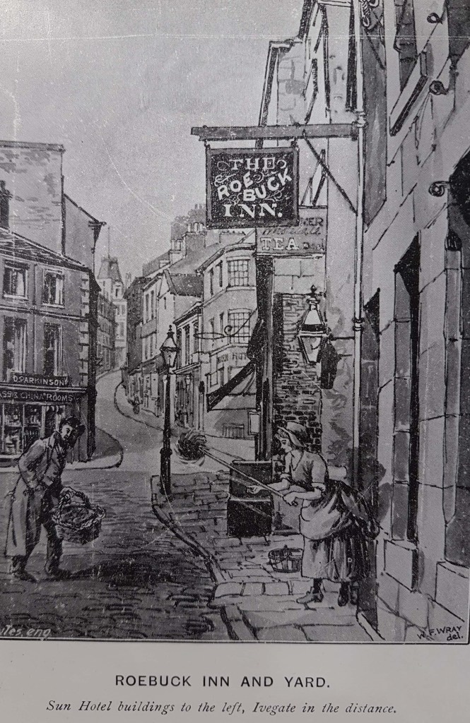
We are lucky enough to have a drawing of the premises, but Kieran explained to me that the Cudworth illustration I know probably employed a photograph as a starting point. The plan is undated but entitled ‘Dyson and others v Corporation, Claimants Plan’. The well-known firm of Dixon & Hart are the surveyors. ‘Claimants Plan’ would seem to indicate that Dyson is a representative land-owner objecting to some plan of the corporation’s, or perhaps the compensation he has been offered to allow such a plan to take effect. I have not been able to positively identify Mr Dyson, but he must own the plot on which the inn sits, jointly with others.
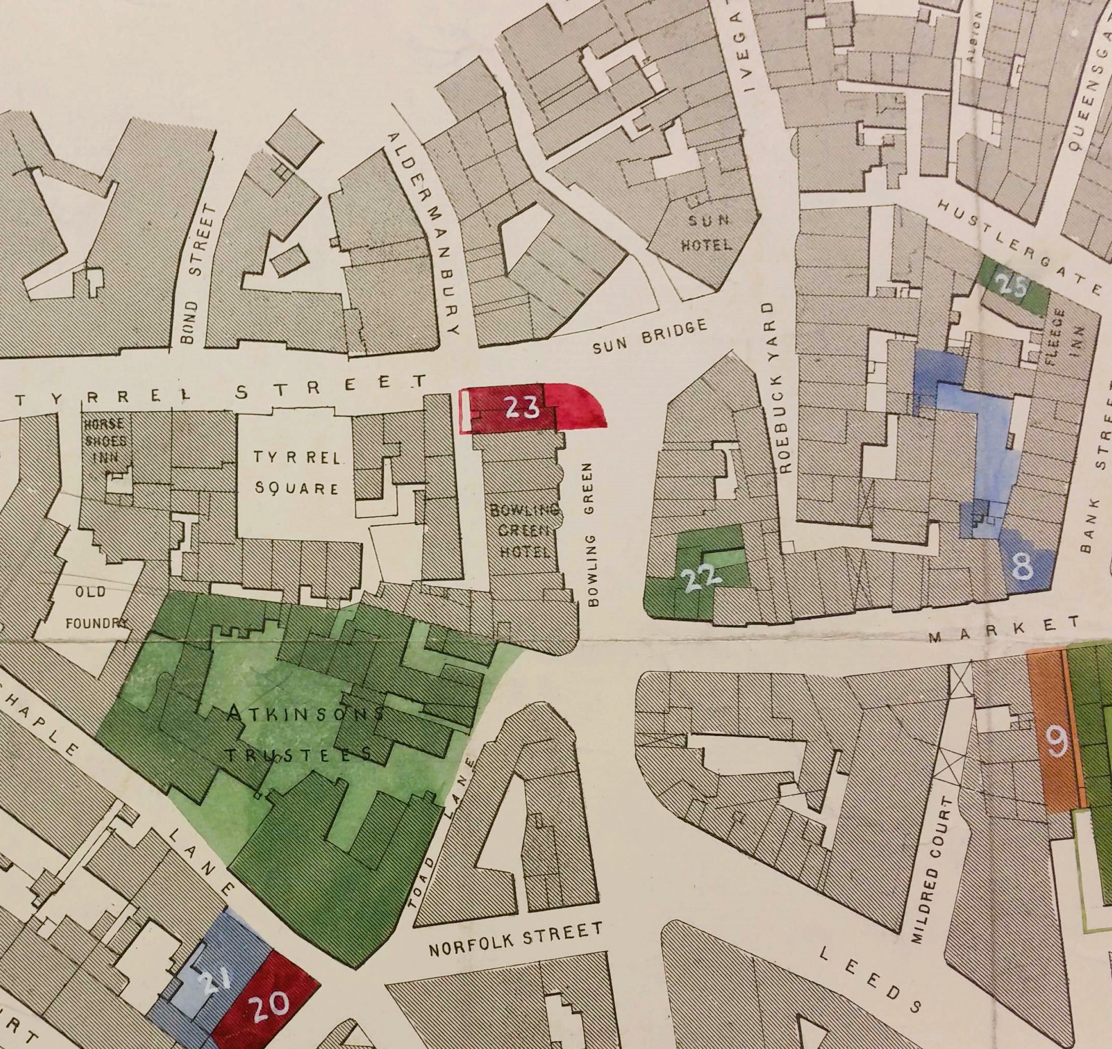
We have a considerable number of maps of this area in the Local Studies Library. The second figure shows the more general picture but note that a portion of Ivegate in the first plan is described as Roebuck Yard in the second. Note the position of the Sun and Bowling Green inns (also significant in Bradford’s history), and also the location of the Sun Bridge.
Essentially, I assume that the inn is being demolished to allow the joining of Ivegate to Market Street. The old street arrangement (as shown in this plan) existed even after the construction of the new Wool Exchange, which shows that the demolition of the inn must have taken place after 1867. The junction certainly was eventually improved: unless I am totally mistaken, the approximate site of the Roebuck was occupied after 1870 by the corner of the large Brown & Muffs building. With the date 1870 carved into its stonework it is easy to be certain about the date of the Roebuck’s end.
A Mr Samuel Thomas, presumably the licensee, died there in 1869 at the age of 59. Later that year the trustees offered it for sale by auction, under ‘a deed of assignment’, through auctioneers Whalley & Co. The Roebuck was mentioned again the following year in connection with a legal case in which the owners of the nearby Hope & Anchor, at the corner of Market Street and Bank Street, objected to the valuation placed on it by the Town Clerk. But the inn is not present in a Bradford Directory of 1872. It looks from a sale notice in the Bradford Observer from 1870 as if the land was now in possession of the council who were selling off ‘builders’ materials’ in Roebuck Yard, and at other neighbouring premises. It was required that the land be cleared in 14 days.
So, if the end came in 1869-70 what about the Roebuck’s early history? There was there was a Roebuck Tavern, Ivegate featuring in the 1822 Pigot Directory, and it subsequently became famous for its role in Bradford Chartism. In 1825 there had been a lengthy strike of hand woolcombers, followed by a recession in the textile industry. Although improved wages for workers was an aim during this time, so was the wish for working men and women to be afforded more dignity and have this dignity recognised by obtaining the vote. The Chartist movement of the 1830s-50s was led by Feargus O’Connor. Since this and all its demands (except for annual parliamentary elections) were obtained in the 19th and early 20th century it puzzles me to understand why Chartism excited such fear and loathing in the citadels of power. Be that as it may Feargus O’Connor addressed a Chartist meeting in Roebuck Inn in 1837 when Peter Bussey was the landlord and a major figure among local chartists. After the physical force Chartism failed Bussey fled to the United States. I have learned that he did eventually return to Yorkshire and resumed his trade as innkeeper but not in Bradford. Ironically, he might well have been alive, albeit at the end of his life, when this plan was drawn-up by the surveyors. He died in 1869 and is buried in Farsley.
A cutting from 1843 gives the then owner of the Roe Buck as one Jonas Sunderland, a farmer of Heaton. He seems to have purchased the Roebuck from the executors of a late owner, Samuel Yates. The Sunderland family are quite well known. A John Sunderland was the first occupier of ‘The Turf’ owned by Benjamin Marriner at the bottom of Emm Lane, Heaton. In the 1841 census Jonas Sunderland is a 30-year-old publican and Cudworth links him with Carr Syke Farm, Frizinghall. The Turf survived much longer than the Roebuck, although it has now been converted into a restaurant. Both these historic Bradford inns have now followed so many others into oblivion. Regular readers will doubtless want to know if the Roebuck was ever in the possession of Rev. Godfrey Wright. Seemingly not although he did own the Bowling Green Hotel in the early 19th century as well as several other hostelries.
 Bradford and District Libraries Map Collections