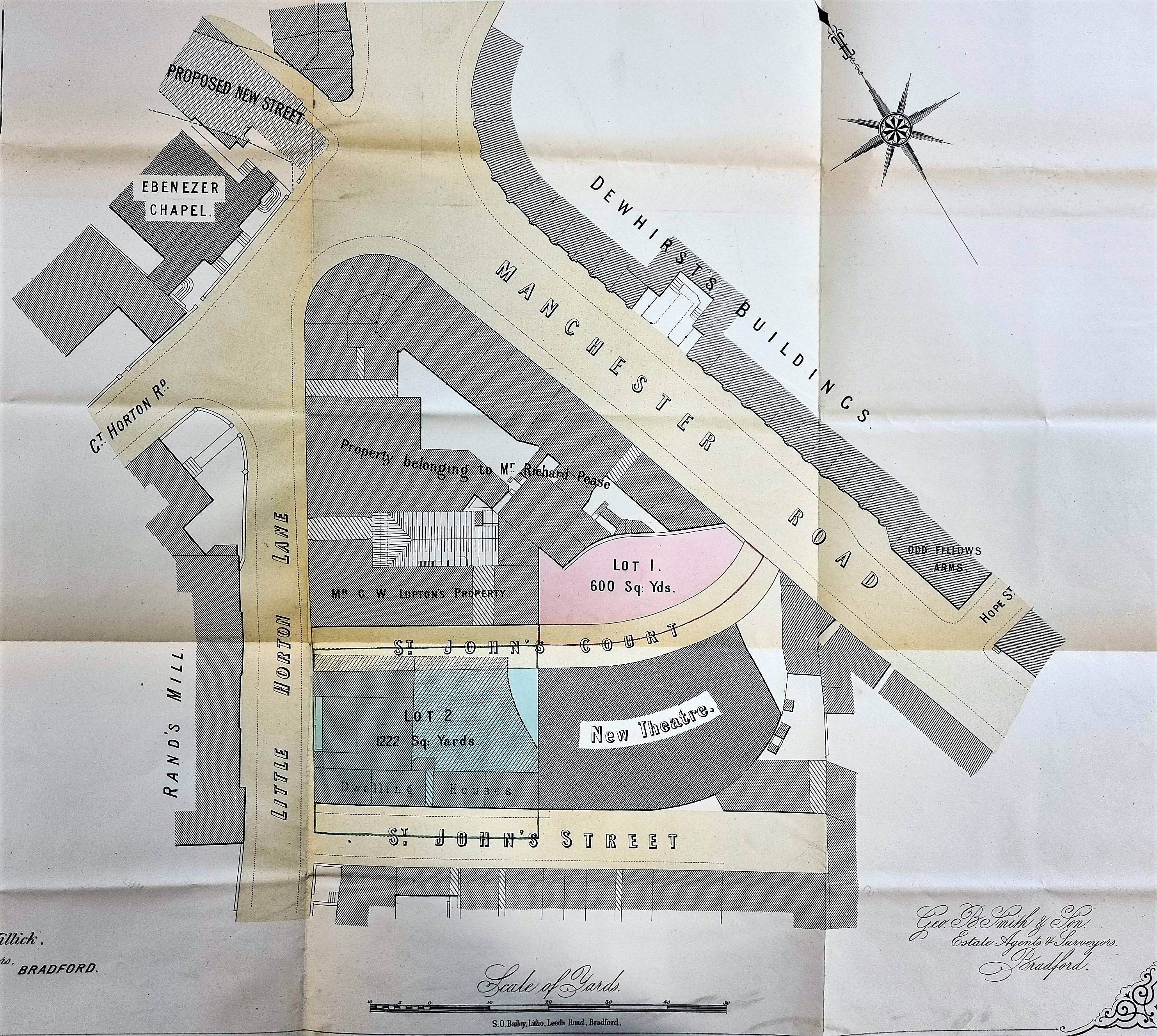
1.12 BRA 1875 WOO BHM 1795 B27
Material: Paper booklet Scale: 10 yards to 1”
Size: 28*42 cm Condition: Fair
Many of the maps I have posted in this series are undated, and their original functions are uncertain. These two examples make a pleasant change. They originated as sale plans dealing with land between St John’s Street and Little Horton Lane, and they are still attached to their original sale prospectus. The prospectus is dated 1875 and the auction took place on 29 April. The well-known Bradford solicitors, Wood & Killick, managed the sale and George Belkin Smith was the surveyor concerned. In fact I imagine that many of the maps employed in this series originated in the same way but have become parted from their parent catalogues over the years. It is even possible that the catalogues still exist in the basement of the Local Studies Library but locating them would require considerable research.
On this occasion the attached sale prospectus details the sale of two plots of land. Plot 1 was formerly part of the site of St John’s Church fronting Manchester Road and a ‘moiety’ of an ‘intended court’. The prospectus mentions that the site is immediately opposite the ‘intended theatre now in course of erection’. Plot 2 fronted Little Horton Lane and extended from St John’s Street to the intended court. The lot included four dwelling houses (whose occupiers are named) together with various sheds and offices. Lot 2 is described as being close to the recently erected warehouse of Mr G W Lupton. You can see this and also make out nearby property owned by Richard Pease. As far as I can tell from census reports Pease was a master brass-founder, long resident in Horton.
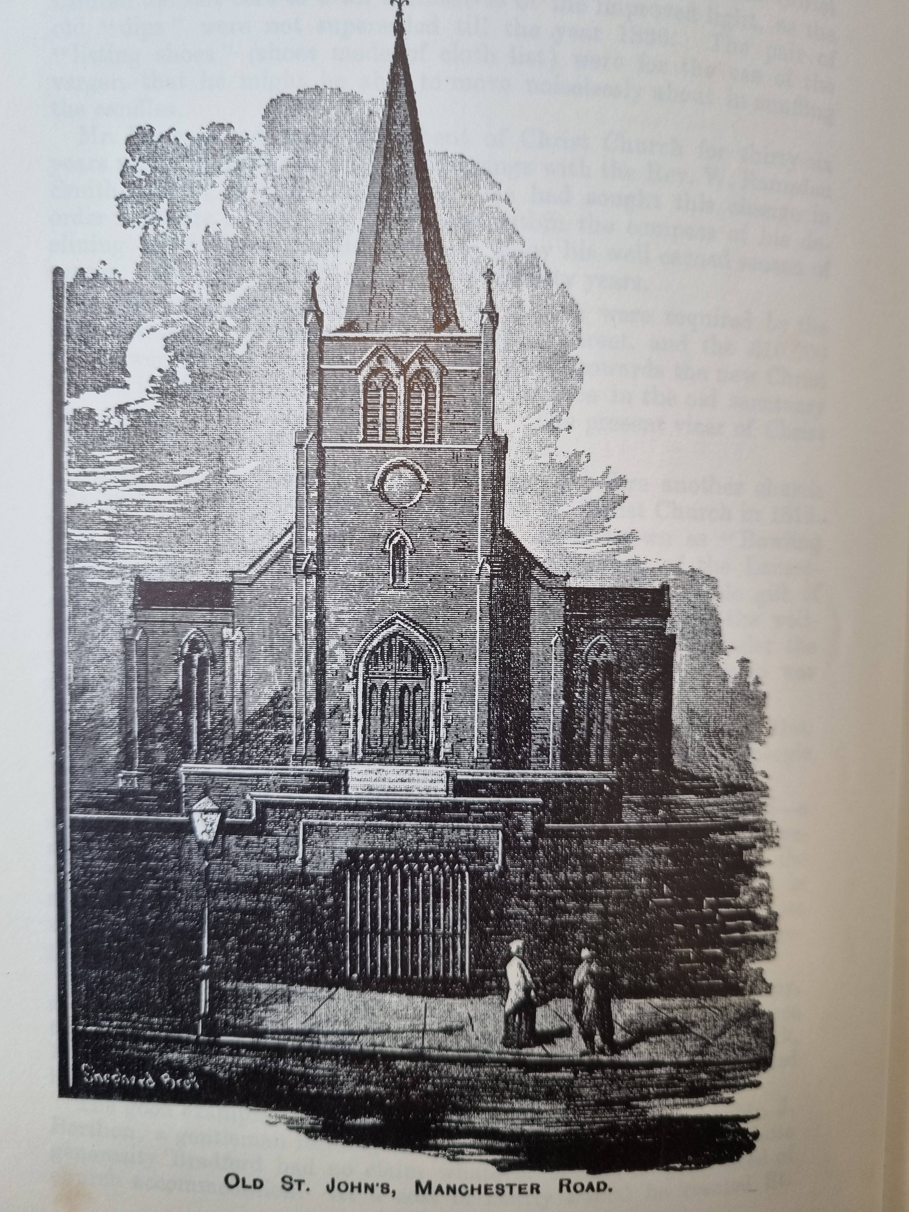
I don’t know a great deal about St John’s Church. William Scruton in his Pen & Pencil Portraits of Bradford says it was erected in 1839. There was seemingly an unhappy dispute between the incumbent, Rev CJ Pearson, and the Vicar of Bradford (and former whaling captain) Dr William Scoresby. The bishop of Ripon had to arbitrate between them. The old building was before long demolished and by the time of our map a replacement church had been built in Horton Lane. In the 1849 Bradford map the church and churchyard occupy much of the central area shown in the first plan. It is surprising how much redevelopment has taken place, which is good evidence of how rapidly the borough of Bradford was changing at this time. By the time of the Ryburn map of 1871 the churchyard seems to have been developed, but the church building itself was still standing, unused.
The Ebenezer Chapel on Great Horton Road was used by the Methodists. It was built on land previously part of the estate of local landowner Rev Godfrey Wright, who features regularly in this series. Rev Wright did not lay up treasure for himself in heaven by providing the land free of charge. Scruton says it cost the Methodists £700. On the far side of Manchester Road you can see the Dewhirst Buildings and the Odd Fellows Arms.
The ‘intended theatre’ became the Prince’s Theatre & Star Music Hall, which is complete and named in the 1912 Bradford map, but I think opened for business in 1876. I believe it occupied approximately the same land on which the church had previously been placed. As you can see from the plan St John’s Court and St John’ Street preserve the church’s dedication.
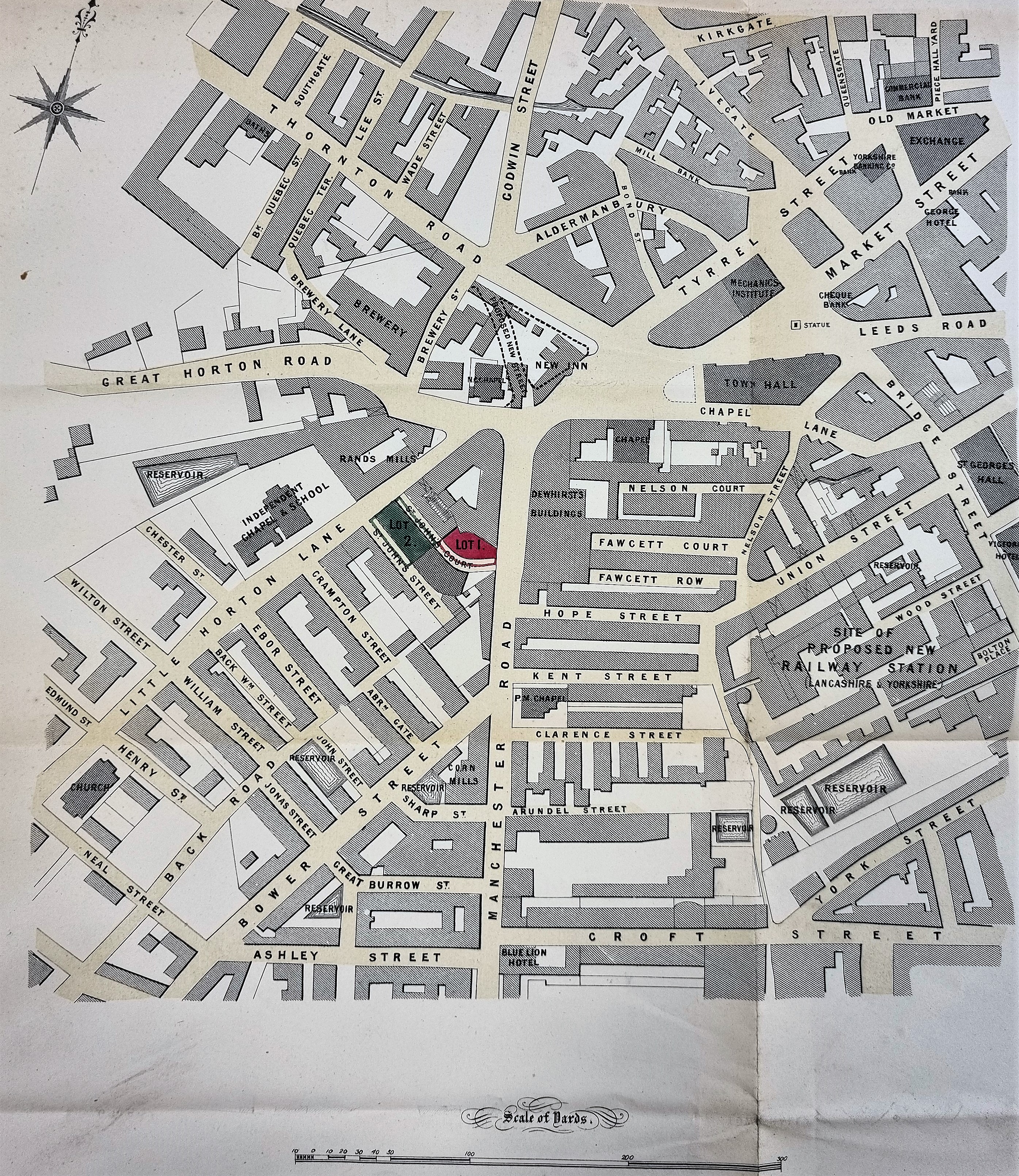
The second map shows a much wider view of Bradford which is valuable in setting the scene. What has happened since? The far side of Little Horton Lane, occupied here by Rands Mill, now has the Queen Victoria Statue placed on it. Beyond that was Horton Lane Congregational Church. Almost everything is now covered by 1960s roads and redevelopment. One of these modern buildings is the Bradford Central Library (now Margaret McMillan House) in the ground floor of which is located the Local Studies Library in which your humble drudge struggles with his reserve maps. Let me conclude with a picture of the church once on this site, which is taken from Scruton’s book.


WHO IS THE HUMBLE DRUDGE? I have spent years researching bradford to establish swaines family tree and property owned. Samuel swaine built a house adjacent to john rands mill his son in law. i am not sure where adjacent would be? can you shed some light on it where he would have built the house after building holm mill. He lived at entrance to legrams lane before that i assume this was legrams house. I did wonder which house woulld be built 1775 it cant be 41 and 43 and 44/45 little horton lane ( later on faith sowrey house) because he built it AFTER leaving legrams house but listed building records state built 1775 the same year an earlier swaine died. So there must be an earlier property I believe this could be coach house because cudworth stated after legrams he built one nearby which is coach house. a joseph swaine stated to live in coach house until 1820 when it was seized by commissioners.
LikeLike