3.015 THO c1840 FIR BHM 659 B10
Plan of Miss Firth’s property in Thornton
Paper Scale: unk. Size: 95*62 cm Condition: fair
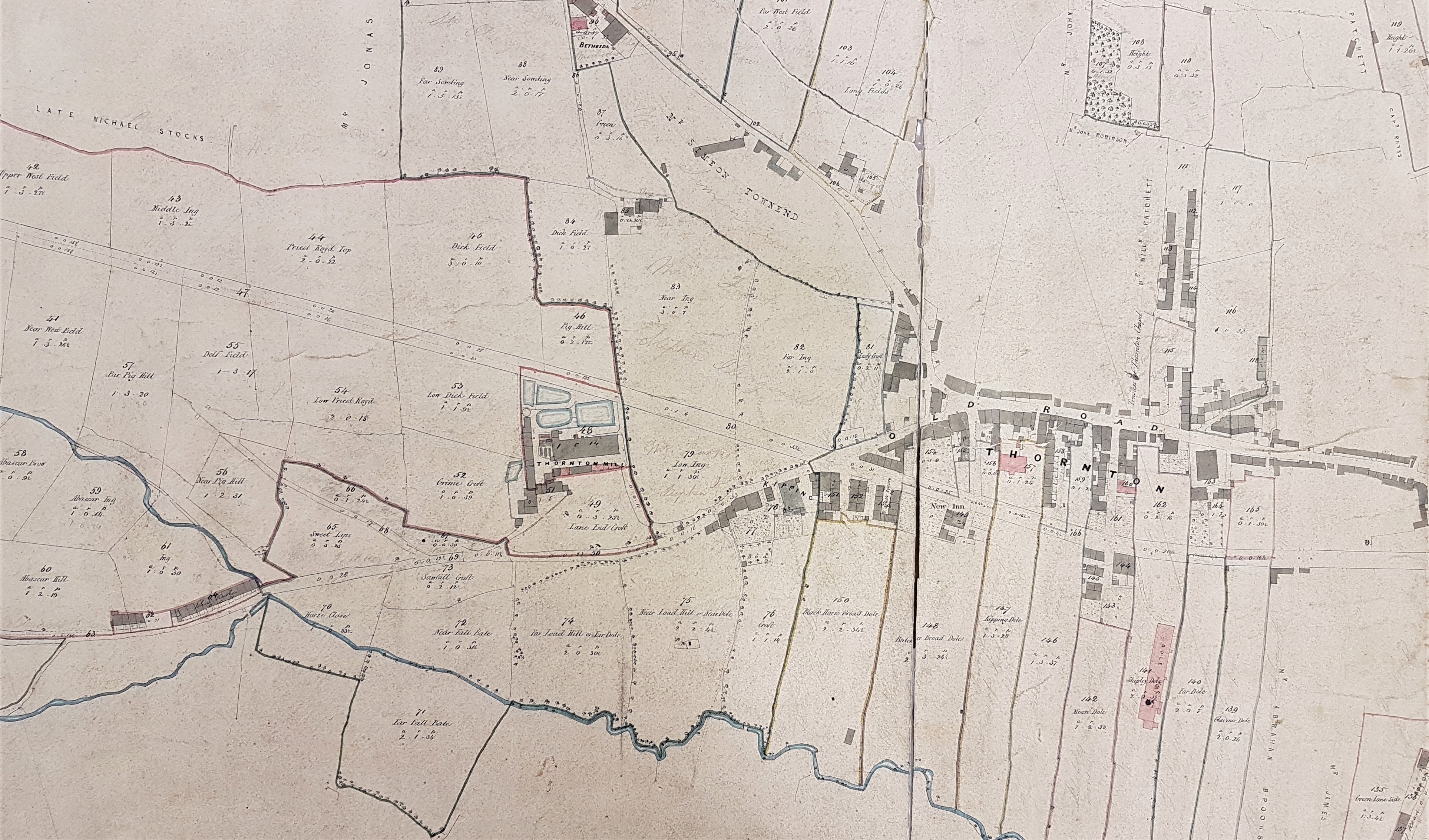
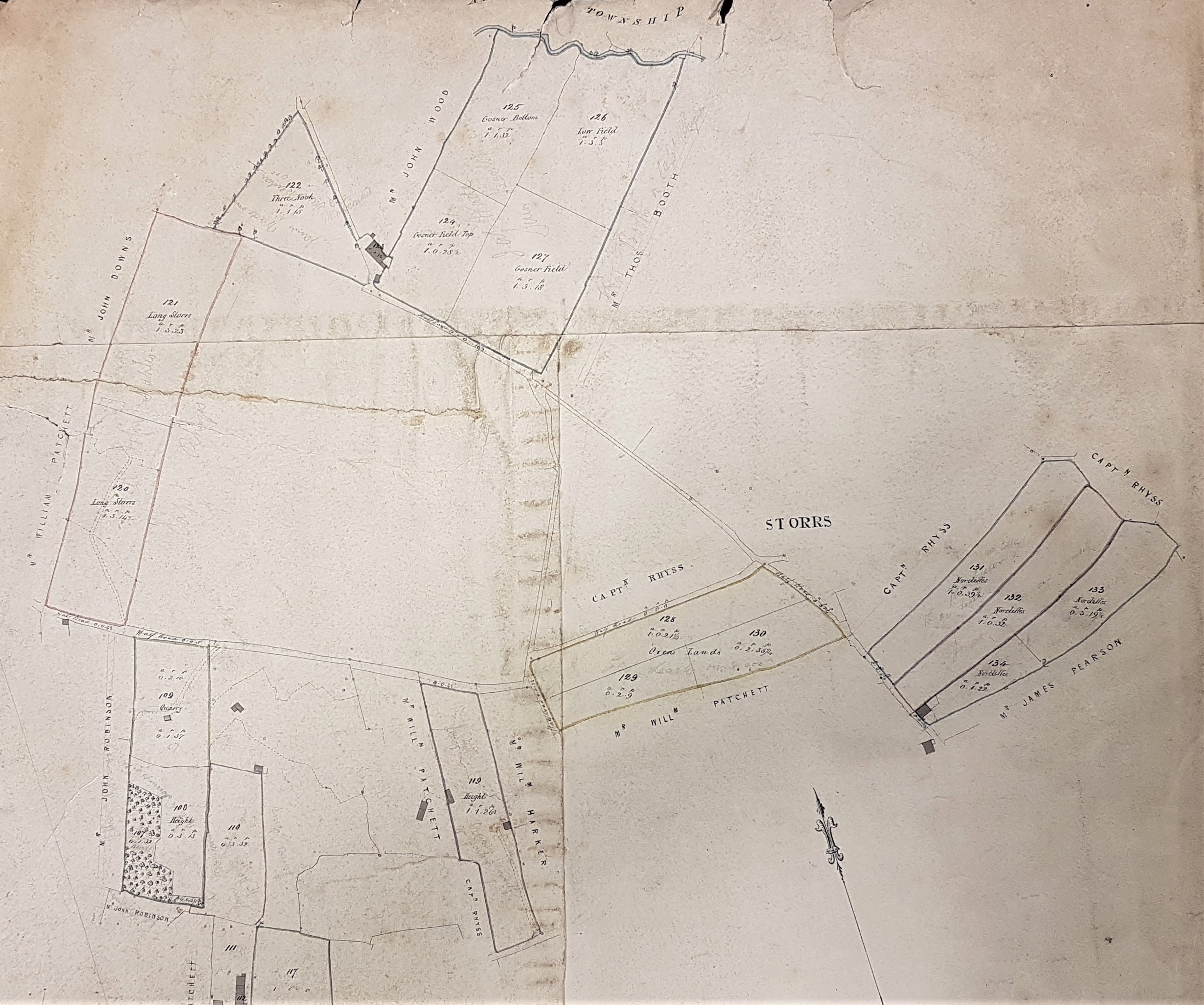
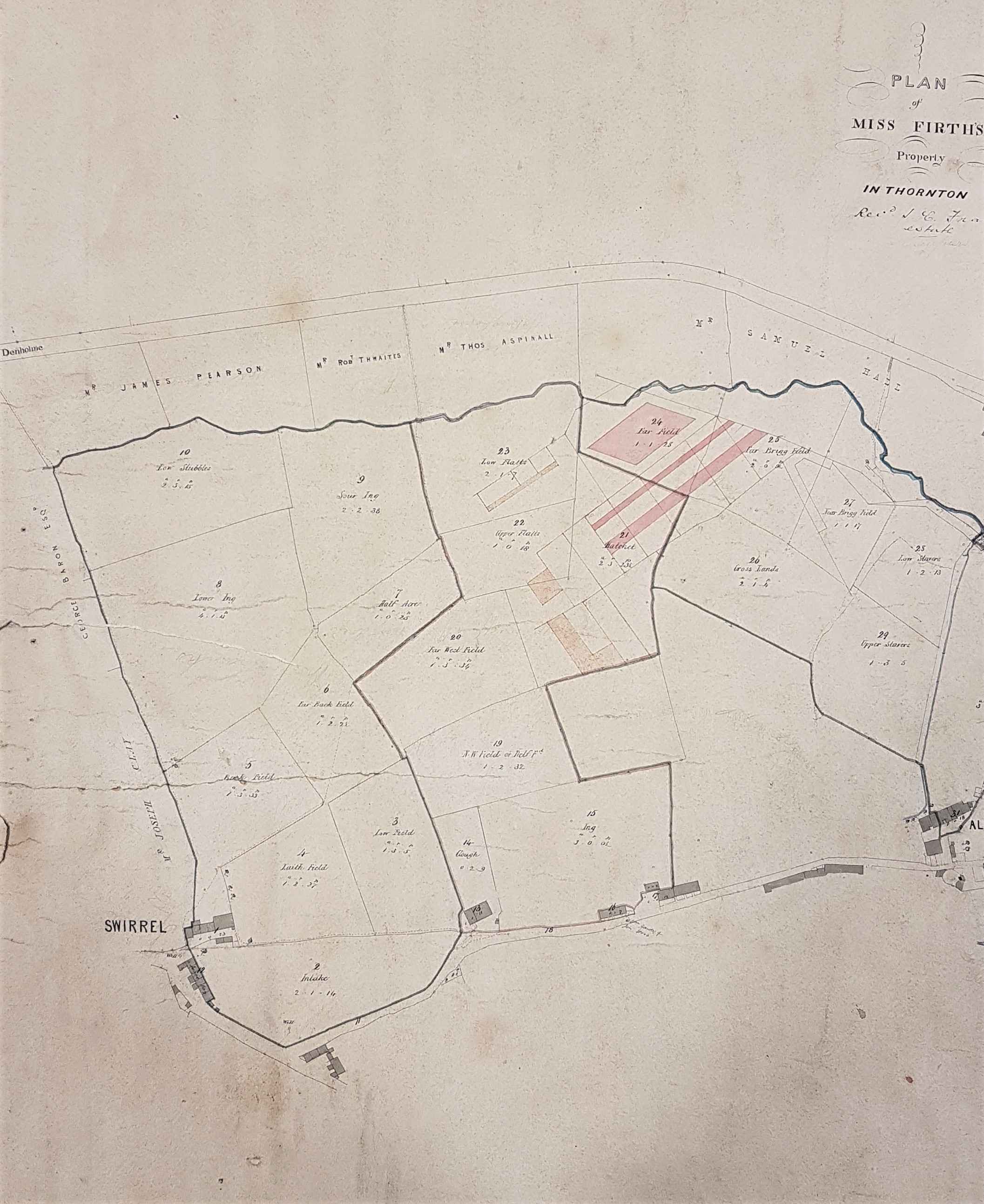
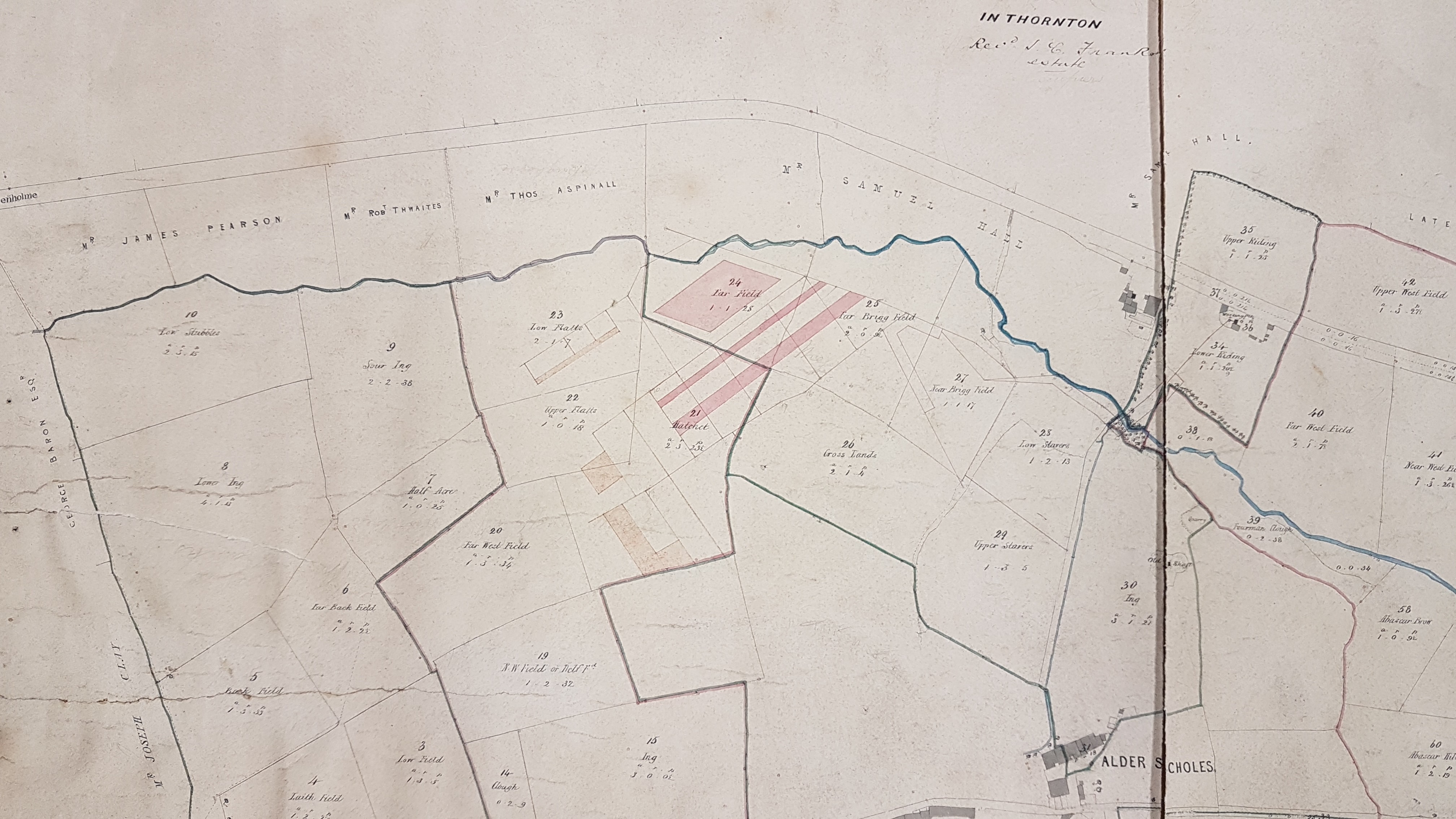
This is rather lovely estate map of Thornton showing properties, field boundaries and land-owners names in great detail. The original map was too large to photograph in its entirety and in any case it now exists in two fragments. The three sections from which I have reproduced details are approximately A1 paper size. The overall arrangement of properties resembles the first Ordnance Survey map of Thornton which was surveyed in the late 1840s. The map is entitled ‘Plan of Miss Firth’s Property in Thornton’. Underneath this printed description someone has added, in ink script, ‘Rev J C Franks estate’. Underneath this in turn is a single word in pencil which may be ‘Occupiers’ but is too faint for certainty. If the map is consistent then land-owners of property adjacent to the estate are added in ink, and pencilled names, scarcely legible here, will be estate tenants.
The name Rev. Franks has appeared before in the Local Studies Library Reserve Collection maps. There is a plan of Kipping in the 1860s entitled ‘plan of projected Upper Kipping Estate, property of Rev James Clark Franks MA’. I made a note that Rev. Franks (1793 – 1867) was the Vicar of Huddersfield but that he clearly had properties in this area, possibly through his wife who was born in Kipping. There is also a railway planning map of 1875 entitled ‘Property required from Rev. John Firth Franks, Alderscholes Lane, Thornton’. The limited type of family history research of which I am capable suggests that the two men were father and son. John Firth Franks (1826-1917) survived until the 20th century and his middle name suggests that the estate passed to his father from Miss Firth by inheritance rather than purchase. His father James Clark Franks, then incombent of Sowerby Bridge, married an Elizabeth Firth in 1824 at St Peter’s Church, Bradford. He had been a fellow at Trinity College Cambridge and seems to have been quite a distinguished scholar. Did he acquire an estate through the death of his wife’s aunt or sister?
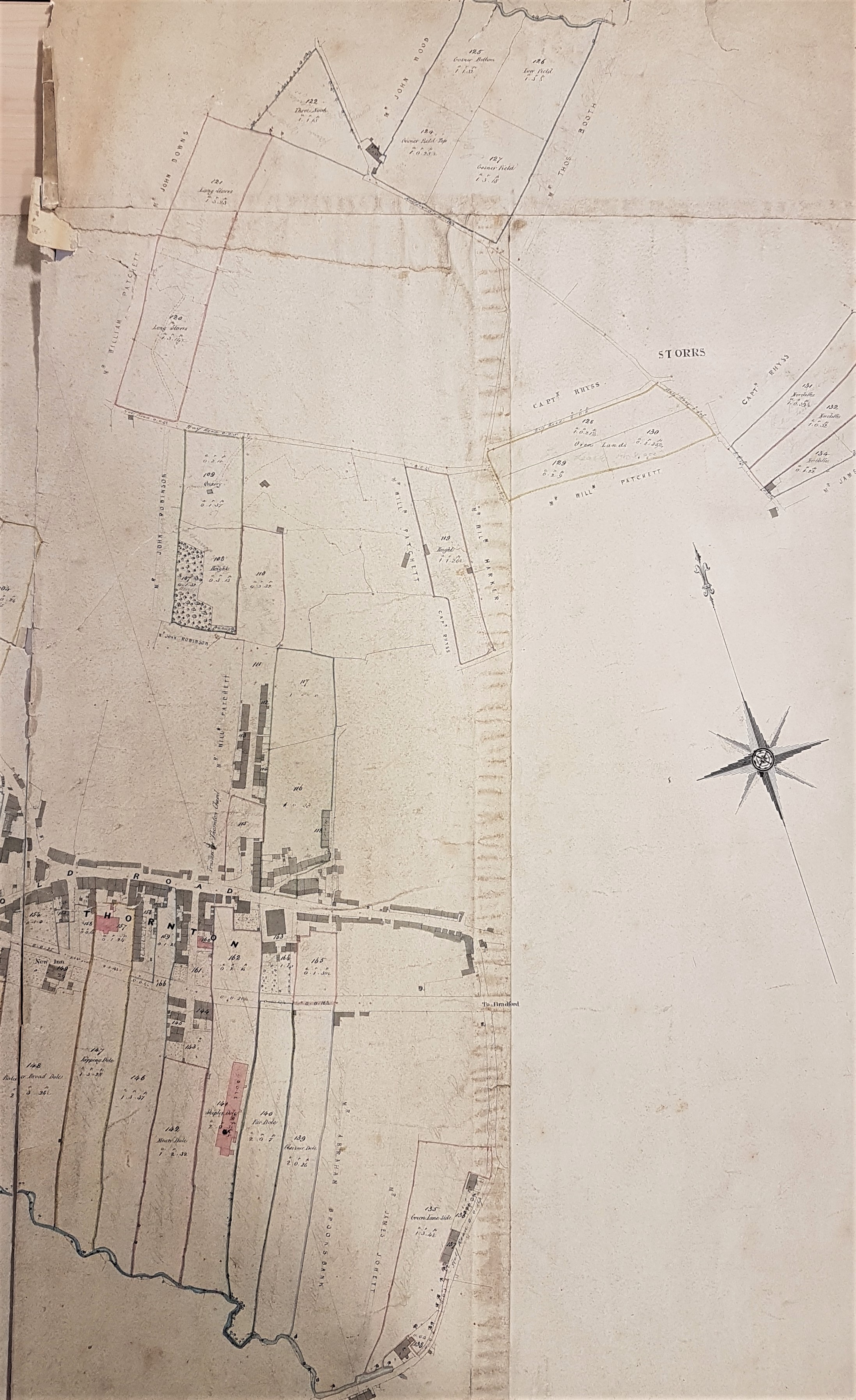
The use of a first name for Miss Firth would have helped the process of identification enormously. We have the 1770 enclosure map for Thornton which suggests that this estate was on land enclosed before the passing of the late eighteenth century Enclosure Act. One of the names of those subsequently awarded parts of the common was a Dr John Firth. William Cudworth in Round About Bradford mentions a Firth family, and in particular a Joshua Firth, living at nearby Allerton Hall in 1777. In 2009 the Thornton Antiquarian Society published Thornton 1751-1938 which is a fascinating collection of newspaper items mentioning the area which was collected by historian Jean K Brown. One from the Leeds Mercury in 1823 mentions that Kipping Mansion House was ‘presently occupied by Mrs Firth’. I can find Miss Firth in Land Tax Records for 1821 and 1823 but since no first name is provided there either I’m not much further forward. Can anybody help?