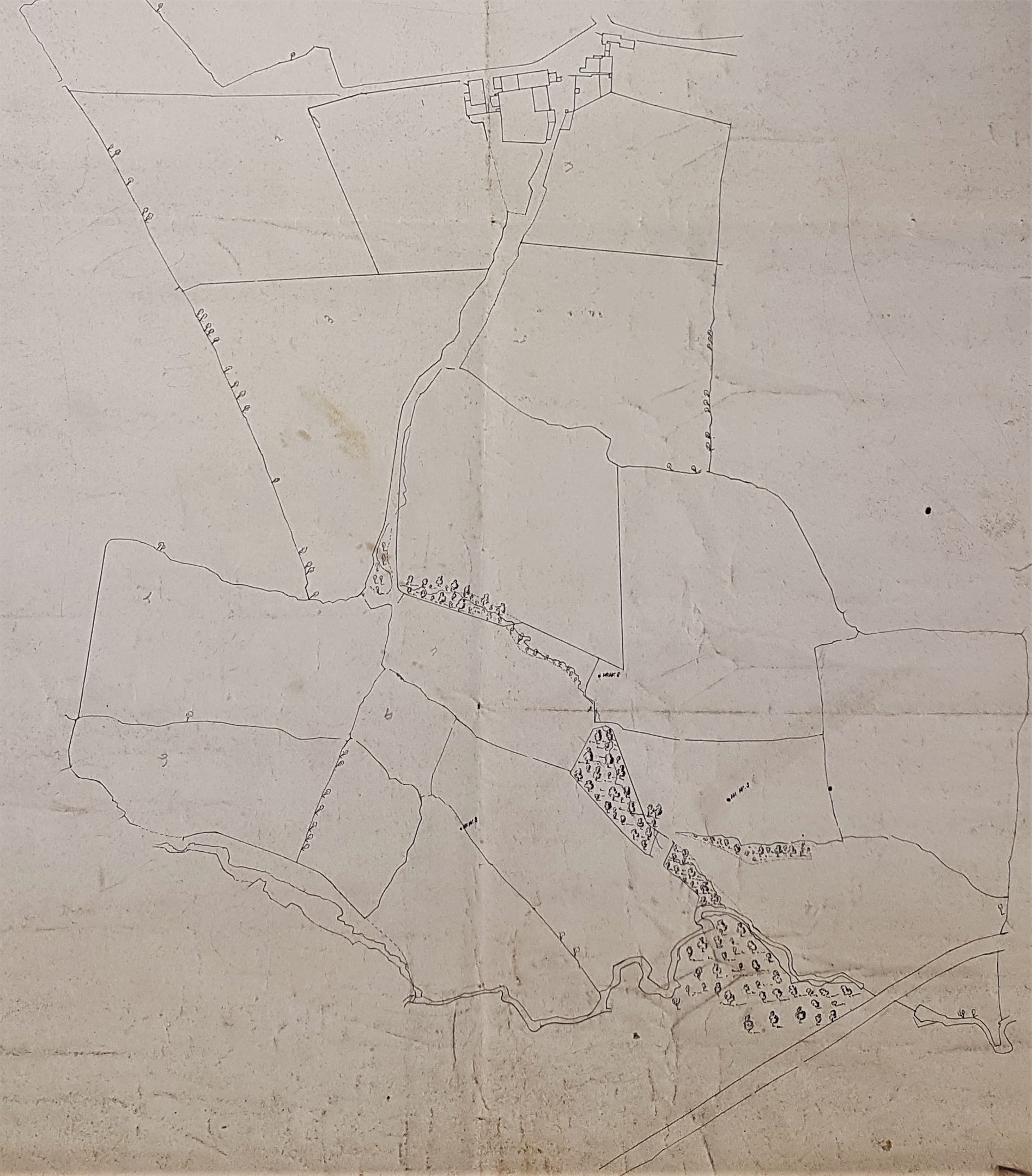
The LSL reserve collection has two carefully drawn, and stylistically identical, estate maps numbered 3.43 and 3.44. Neither is dated nor has a direction indicator. In fact there are virtually no annotations of any type on the plans themselves, but on the back surfaces are these rubrics:
3.43 A6a ‘Allerton Grange Estate, 3 chains to one inch’
3.44 AA2 ‘Mr Rawson’s Hell Cliffe Estate, Allerton’
Both plans must represent portions of Allerton, and at first sight it seems likely that both represent portions of the unknown Mr. Rawson’s estate. Considering the first plan in detail:
3.043 ALL c1850 PLA BHM 725 B11
Allerton Grange Estate
Paper Scale: 3 chain per inch Size: 54 *43 cm
Condition: fair
This is fine ink-drawn plan without a date or label except three points marked ‘W.W.S’ and some pencil numbers. An obvious watercourse is included together with a single group of buildings. There is not much doubt that the building in the plan is Allerton Grange, in which case the top of the plan, as I have displayed it, is directed east. The watercourse is the beck flowing through Boggart Wood and under the Bradford & Thornton turnpike to join the Middle Brook. The plan closely resembles the first Ordnance Survey map of the area which would have been surveyed in the late 1840s. The field boundaries in the two maps closely match. There were land enclosures in the Allerton area in 1844. Both these pieces of evidence contributed to my provisional date. Although the estate contains no collieries we can be sure, as evidenced by the OS map, that coal was extensively mined in the surrounding fields which were presumably under different ownership.
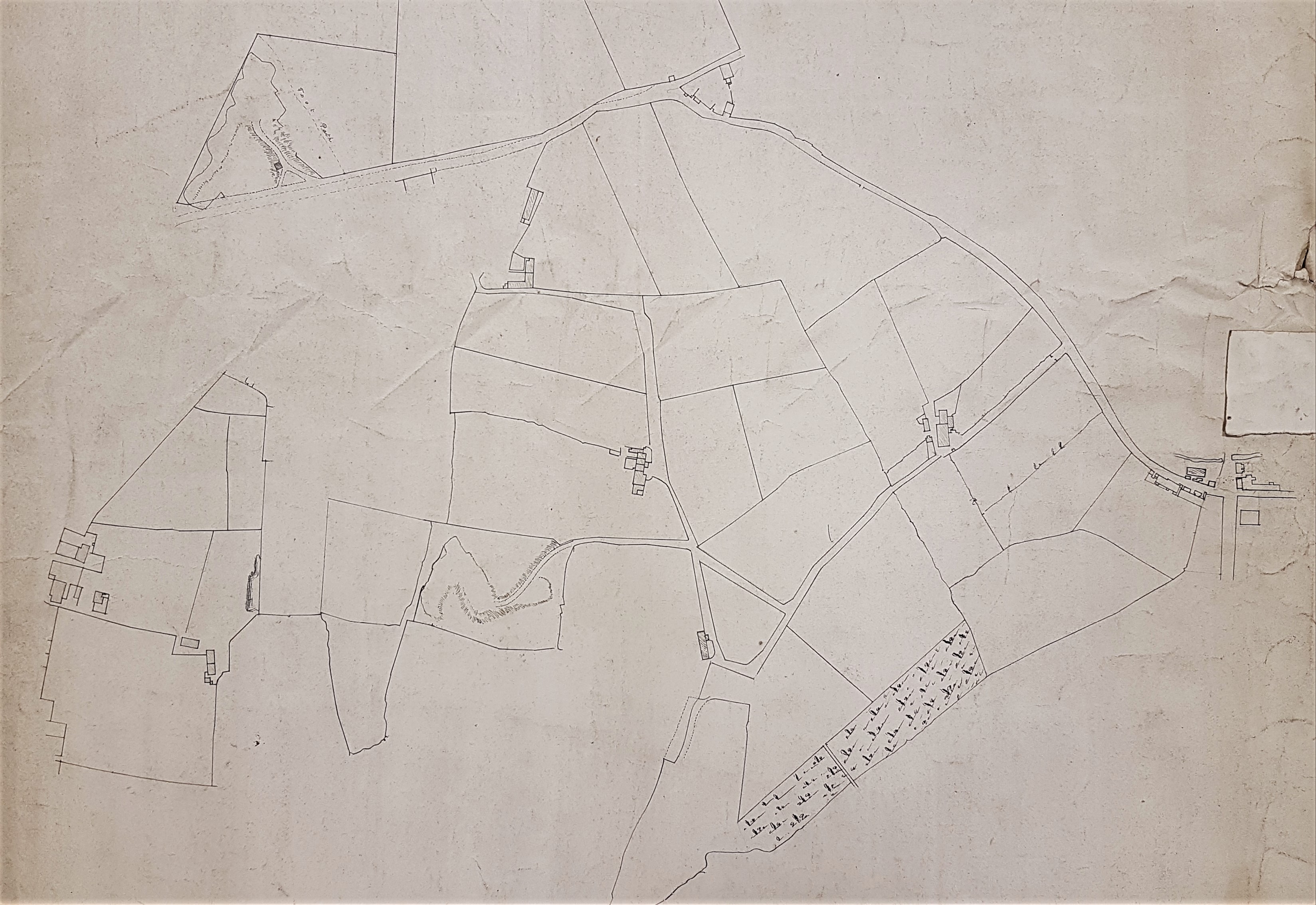
The second plan is not so straightforward to identify since the title, ‘Hell Cliffe Allerton’, is not helpful:
3.044 ALL c1850 PLA BHM 728 B11
Paper Scale: unk Size: 54*43 cm Condition: fair
It is reasonable to assume that this plan represents another portion of Allerton around 1850, and that it is drawn to the same scale. I don’t recognise Hell Cliffe as a place name and nor, which is much more important, does William Cudworth. My best estimate is that it represents the area north of Guide Moor, west of Allerton township, and the fields are on both sides of Stony Lane. Near Allerton the ground is extensively quarried and this is hinted at in the plan. The estate continues ‘below’ the course of Stony Lane as I have orientated the plan. The complicated junction to the right of the plan is modern Sandy Lane (or Swain Royd Lane Bottom on the first OS map). It is not clear which, if any, of the small buildings is associated with the land. In the lower centre of the map is a rather inconspicuous building adjacent to an odd four-sided road pattern. This is called Hill Cliff in the first OS map, as are some of the adjacent quarries, so the question of a misspelled map title must be considered likely.
In the 1860s both the Bradford Observer and William Cudworth link Allerton Grange with William Fairbank and James Fairbank who were coal owners, farmers and brick makers. I can demonstrate that they were using Allerton Grange as their address by 1852 and William Fairbank owned nearby Allerton Grange Colliery as early as 1848. The pages of the Bradford Observer reveal that a number of other people used Allerton Grange as their address but they may well be occupiers rather than owners, or the building might have been in multiple occupancy. For example Benjamin Burran died at Allerton Grange in 1846, and Elizabeth, Henry W Blackburn’s wife, died there in 1850. On a more optimistic note Thomas Campbell used this address when he married in 1852.
So who is Mr Rawson? Benjamin Rawson (1758-1844) was a well-known Lord of the Manor of Bradford, He lived at Nidd Hall, near Knaresborough which he bought in 1824. Rawson died in 1844 which is a close approximation to the provisional map date and could provide a motive for its survey. On the other hand Rawson is a reasonably common surname and I have no positive evidence yet that Benjamin Rawson had property in Allerton.


I can identify Hell Cliff in Allerton as we used to play there as kids in the 1940’s.
Go to top of Allerton village and turn right on North Parade follow it to the end of the tarmac and continue down the unmade road until it bears left. Go through the gate on your right and turn left across the field passing the disused quarry on your right until you come to a steep escarpment in front of you. We allways referred to this as Hells Cliff.
I came across your reference to “Rawson’s Hell Cliff Estate”when researching my great grandfather Wilkinson Patefield who I believe was involved in stone extraction in Allerton in the 1870’s, probably at Grange Quarry.
Hope this is of interest to you.
LikeLike